17. Applications and Implications
Group assignment:
None
Individual assignment:
-
Propose a final project masterpiece that integrates the range of units covered, answering:
-
What will it do?
- Who has done what beforehand?
- What will you design?
- What materials and components will be used?
- Where will they come from?
- How much will they cost?
- What parts and systems will be made?
- What processes will be used?
-
What questions need to be answered?
-
How will it be evaluated?
-
Your project should incorporate:
-
2D and 3D design
- Additive and subtractive fabrication processes
- Electronics design and production
- Embedded microcontroller interfacing and programming
- System integration and packaging.
1. Project Overview
My final project consists of designing and building an interactive electronic map of Côte d’Ivoire.
The system uses LEDs to represent cities where the UNDP (United Nations Development Programme) has carried out activities and development projects.
Each LED corresponds to a specific city and lights up to indicate the presence of UNDP actions in that region.
The project combines:
- Digital fabrication
- Electronics
- Embedded programming
- Interactive visualization
2. What Will the Project Do?
The project will: - Display the map of Côte d’Ivoire - Illuminate LEDs representing cities where UNDP projects are implemented - Create an interactive visualization system - Demonstrate embedded electronics and digital fabrication integration
Possible future improvements: - Interactive buttons - Web or mobile control - Data visualization system - Animated lighting sequences
3. Previous Related Work
Several interactive maps and educational visualization systems already exist.
Previous projects include: - Interactive LED world maps - Smart educational geographic displays - Embedded visualization systems using LEDs and microcontrollers
However, this project specifically focuses on: - Côte d’Ivoire - UNDP activities visualization - Local educational and awareness applications
4. What Will I Design?
I will design: - A physical map of Côte d’Ivoire - Electronic circuits for LED control - A custom PCB - Embedded software for LED management - Structural support and packaging
The design includes: - 2D vector design of the map - 3D support structures - Electronic integration
5. Materials and Components
The project will use:
| Component | Function |
|---|---|
| ESP32-WROOM-32D | System control and Wi-Fi/Bluetooth communication |
| LED RGB (common cathode) | Visual status indication |
| Resistors (220 OHM) | Current limitation for LEDs |
| Capacitors (2.2µF) | Power supply filtering and decoupling |
| TFT Display (ST7735) | User interface and data visualization |
| Jumper Wires | Electrical connections between components |
| Power Supply (5V 2A) | System power |
| PCB Board (copper) | Electronic connections and circuit support |
| Acrylic / MDF | Structural housing and mounting |
| PLA Filament | 3D printed enclosure components |
6. Source of Materials
The materials and components will come from: - Local electronics stores - Fab Lab inventory - Online suppliers
Possible suppliers: - Electronics shops - Hardware stores - Digital fabrication laboratory resources
7. Estimated Cost
| Component | Origin | Price ($) | Quantity | Subtotal ($) |
|---|---|---|---|---|
| ESP32-WROOM-32D | Digikey | $4.08 | 1 | $4.08 |
| LED RGB SMD 5050 (common cathode) | Digikey | $0.45 | 5 | $2.25 |
| RES SMD 220 OHM ¼W 1206 | Digikey | $0.10 | 10 | $1.00 |
| CAP CER 2.2UF 25V 1206 | Digikey | $0.20 | 5 | $1.00 |
| TFT Display 1.8" SPI ST7735 128x160 | Amazon | $6.50 | 1 | $6.50 |
| CONN Wires + Dupont Jumpers (M-F, M-M) | Amazon | $5.00 | 1 set | $5.00 |
| Power Supply 5V 2A (USB adapter) | Amazon | $8.00 | 1 | $8.00 |
| PCB FR4 (copper, custom etched) | JLCPCB/FabLab | — | 1 | $12.00 |
| Acrylic/MDF sheet 3mm – 100x100mm | Local supplier | $4.00 | 5 sheets | $20.00 |
| PLA Filament 1.75mm (3D printing) | Prusament | $24.99/kg | 1kg | $24.99 |
| Total | | | | $84.82 |
8. Parts and Systems to be Made
The project includes:
- Physical map structure
- LED lighting system
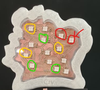
- Electronic control board
- Embedded software
- Support structure and packaging
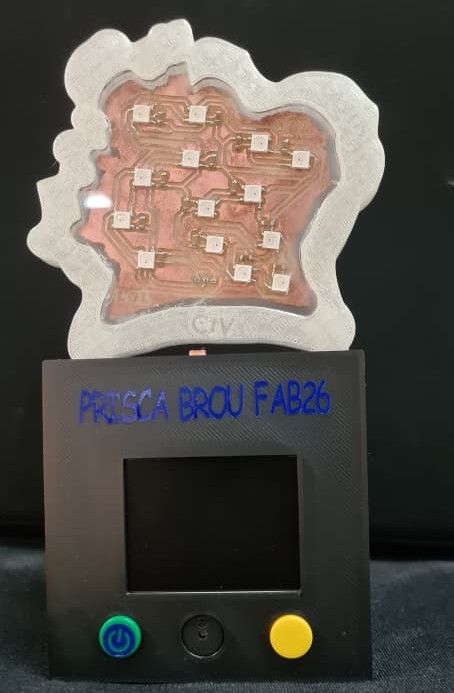
Main systems:
- Mechanical system
- Electronic system
- Embedded control system
9. Processes Used
The fabrication process includes:
A: 2D Design
- Vector drawing of the map
B: 3D Design
- Support and enclosure modeling
C: Additive Fabrication
- 3D printing of supports
D: Subtractive Fabrication
- CNC cutting or laser cutting of the map
E: Electronics Production
- PCB design and soldering
F: Embedded Programming
- ESP32 programming
- LED control system
G: System Integration
- Assembly of all components
10. Questions to be Answered
Important questions during development: - How to optimize LED placement? - How to improve system reliability? - How to organize electronic wiring? - How to make the system scalable? - How to improve visual presentation?
11. Project Evaluation
The project will be evaluated based on: - Functionality of the LEDs - Quality of fabrication - Electronic integration - Programming performance - Final presentation - Innovation and creativity - System reliability
The success criteria include: - Correct LED operation - Accurate representation of cities - Stable embedded system - Clean assembly and packaging
12. Integration of Fab Academy Topics
This project integrates multiple Fab Academy units:
| Topic | Integration |
|---|---|
| 2D Design | Map vector design |
| 3D Design | Structural supports |
| Additive Fabrication | 3D printed components |
| Subtractive Fabrication | CNC/Laser cutting |
| Electronics Design | PCB creation |
| Embedded Programming | ESP32 coding |
| Microcontroller Interfacing | LED control |
| System Integration | Complete assembly |
In summary, I can conclude that
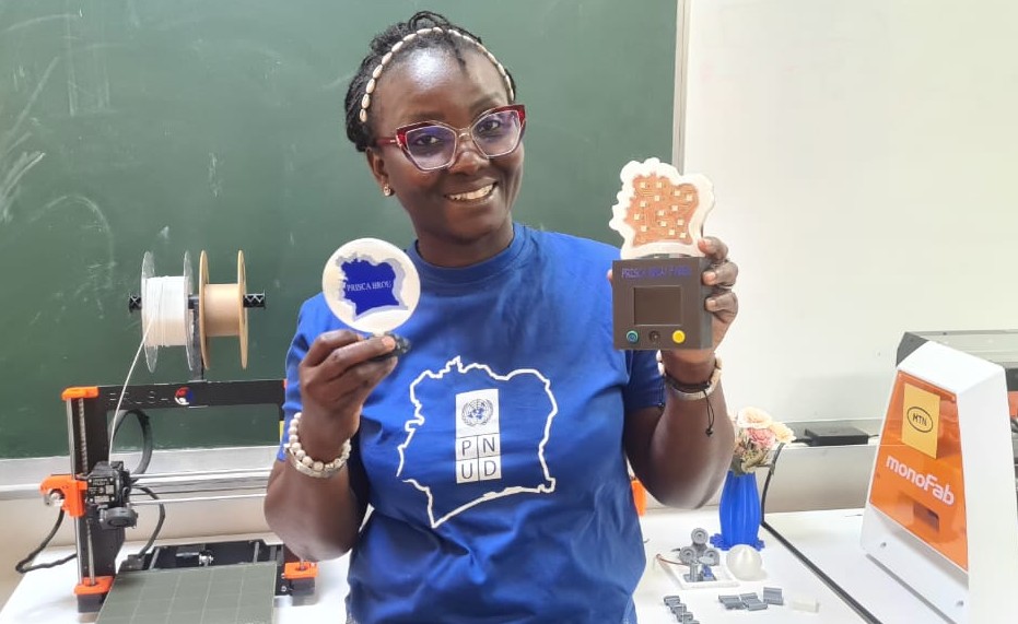
This project demonstrates the integration of digital fabrication, electronics, embedded systems, and interactive visualization. By combining these disciplines, it offers a tangible example of how engineering and fabrication skills can be applied to address real-world communication challenges.
At its core, the interactive map of Côte d'Ivoire provides an innovative way to visualize UNDP activities across the country. Beyond its functional purpose, it also showcases the engineering and fabrication expertise developed throughout the Fab Academy program, bridging technical learning with practical application.
Ultimately, this project will serve as a powerful tool for communication and resource mobilization. It stands as a tangible demonstration of manufacturing technology and project management capabilities, offering a panoramic view of the diverse and multiple interventions carried out by organizations and national stakeholders.