W1 - PRINCIPLES AND PRACTICES
W1 - REFERENCES
link:DIY drone
link:new environmental tools
In the first week of the fab academy we were asked to propose a final project.
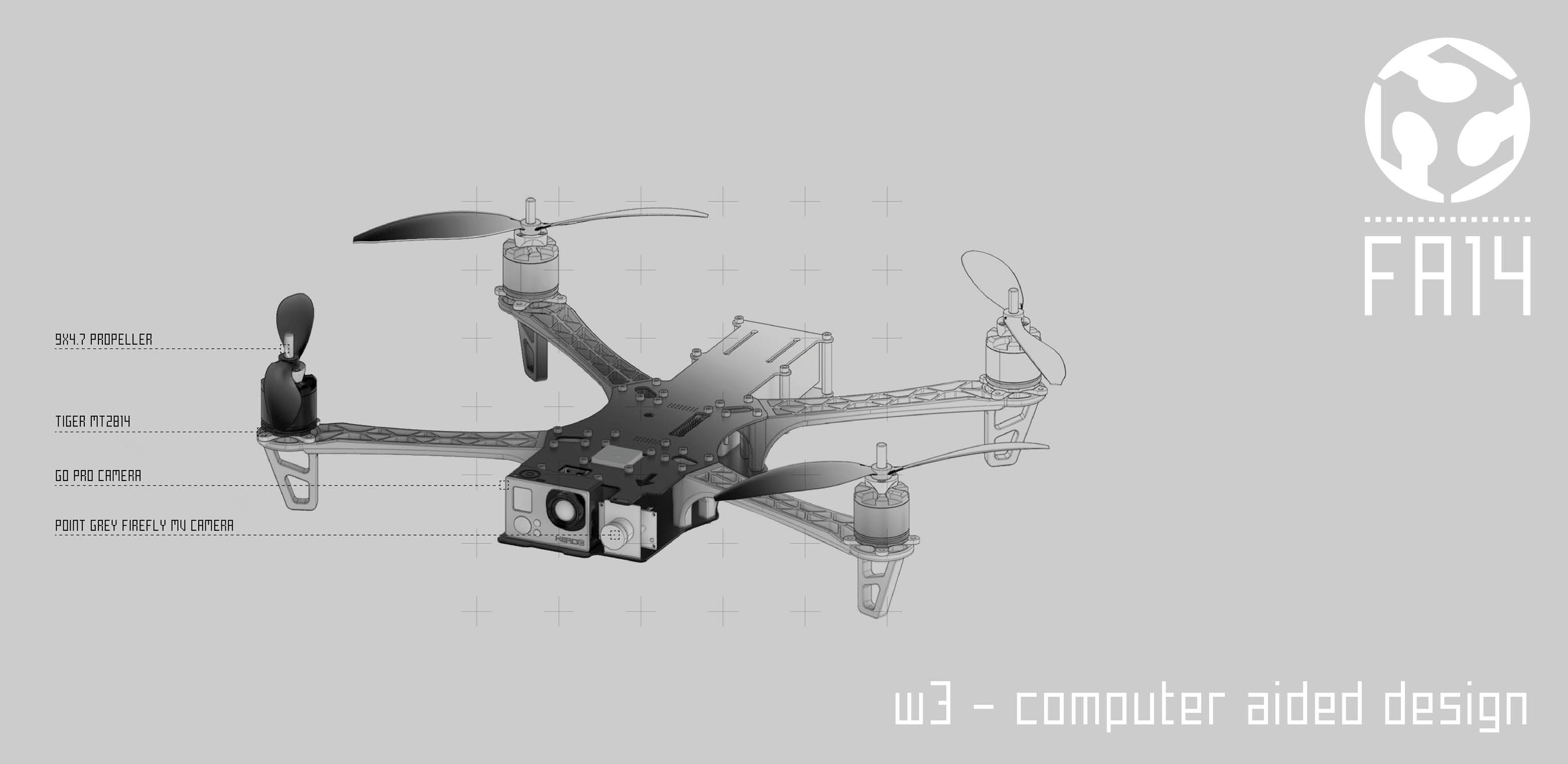
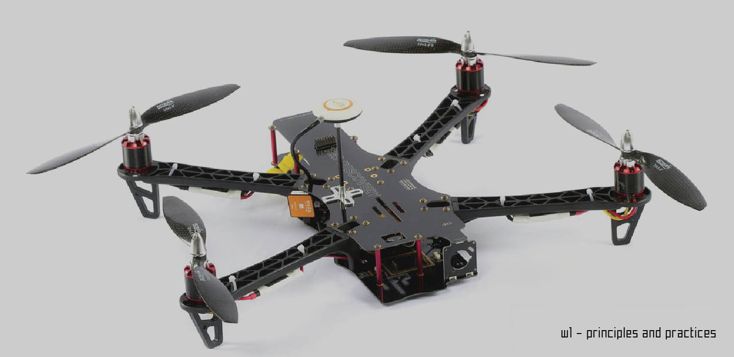
My proposal concern the fabrication of a drone. I'm very interested a robot that is not only a game but in fact a real tool that can be used for the better understanding of the environment, for the creating of 3dimensional models, for the recollection of data.
It would be also very intersting to build one completely opensource. Starting from the mechanical part to the electronics and programming.
I see the academy as the starting point of a possible research that can develope further on other directions.
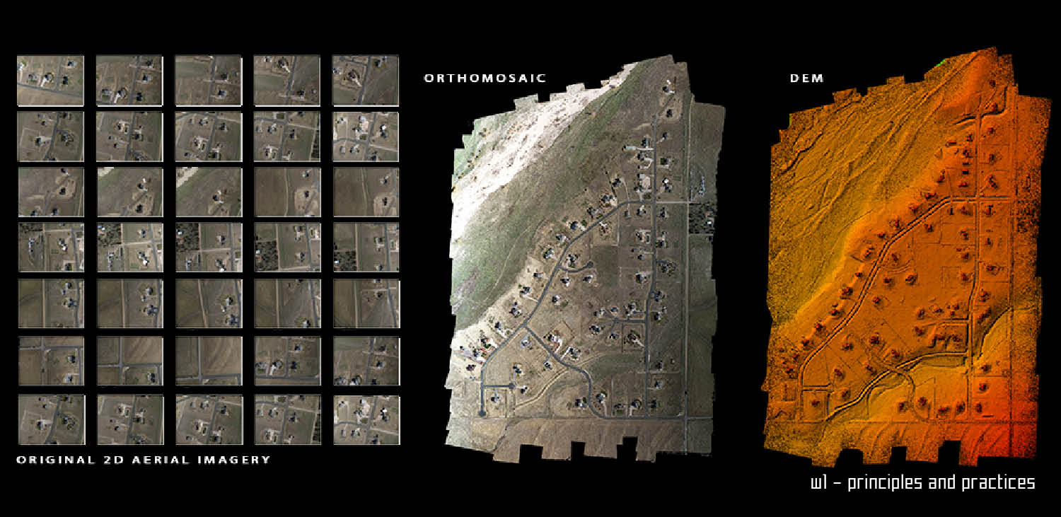
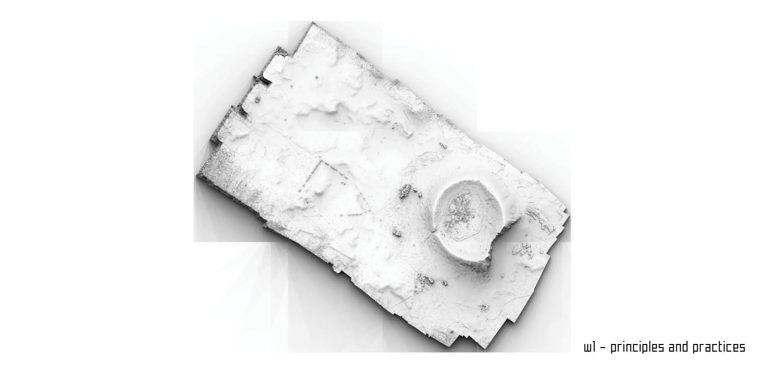
Up-to date aerial imagery acquired in a user-friendly and fast way and translated into highly accurate multiband orthomosaics and DSMs is a cost effective and user-friendly new way to continuously optimize precision farming techniques.
The recollection of data using drone can go from Agriculture / Crop Stress / NIR / NDVI / EVI / EVI2/ Oil and Gas/ Mining, Volumetrics/Pipeline Monitoring / ROW / Insurance/Powerline Monitoring / Infastructure/ Construction/ Wildlife Management/ Flood Management/ County / City Planning/
Real Estate / Development Planning/ Disaster Response (Oil Spills / Flood Mapping / Fire Mapping)/ Insurance / Damage Assessement
Law Enforcment / Military Mission Planning/ Research / Academia/ Surveying / LIDAR/ Change Detection/ Archeology/ Remote Sensing/ GIS Consulting/
GIS Software Development/ GIS Database Development/ GeoServer Consulting/ Precision Geo-spatial Intelligenc/ Photogrammetry Consulting and Software Development/ Web Harvest and Public Data Source Collection.
The goal of the academy is to understand how drones are made. Next step will be to study those machine and develop them as a novel ways to amass environmental data.
Related Projects